Leander Elite Concrete works as a concrete contractor in Steiner Ranch, TX, building driveways, patios, walks, slabs and pool decks with more than 20 years of experience on this kind of ground. There is something unusual about estimating here, and it works in the client’s favor: excavation costs are far more predictable than they are almost anywhere else we work.
The reason is uniformity. A systematic sample of 291 interior points returned only five soil map units across the whole community, and two of them account for 92.8 percent of points. Roughly 93 percent of this place sits on the same kind of ground.
That is genuinely unusual, and it means a neighbor’s excavation cost is a real predictor of yours rather than an anecdote. On most sites we price rock as a risk because we cannot know what a machine will meet; here we can be far more specific before anything is opened up.
One Ground Under Nearly the Whole Community
Two Map Units, Ninety-Three Percent of the Ground
The Brackett-Rock outcrop complex on 1 to 12 percent slopes covers 62.9 percent of sampled points, and the Brackett-Rock outcrop-Real complex on 8 to 30 percent slopes covers a further 29.9 percent. The remaining three units together account for roughly 7 percent.
What that means practically is that the base case underfoot is known before we arrive. We still verify on site, because the exception matters when you land on it, but the starting assumption is well founded rather than a guess.
It also means quotes across the community are comparable in a way they usually are not. When two contractors price the same excavation very differently here, the difference is much more likely to be in method or margin than in what either expects to hit, and that is a useful thing for a client to be able to assume. We are happy to explain which unit a lot sits on and what it implies, because the information is public and it makes an estimate easier to check rather than harder. A number nobody can interrogate is a number that has to be taken on trust.
Rock Outcrop as a Mapped Component, Not a Surprise
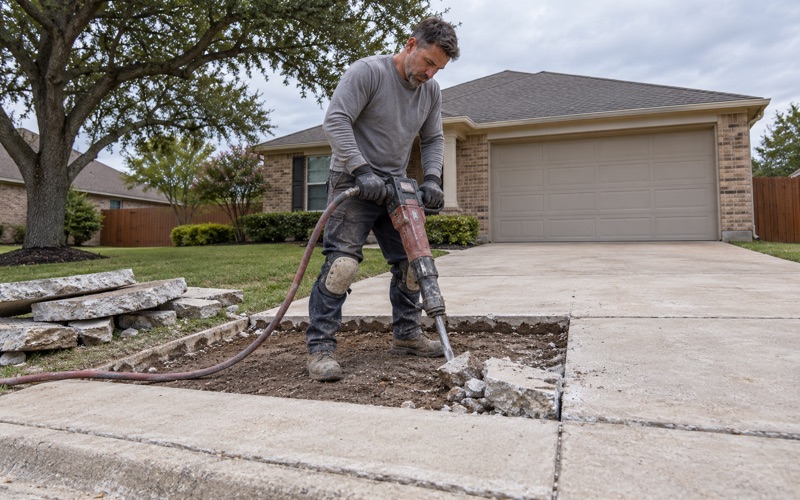
Bare rock is part of the mapping rather than an anomaly inside it: rock outcrop makes up 20 percent of the gentler unit and 25 percent of the steeper one, with indurated bedrock at the surface. On roughly 30 percent of the community, about one point in four is expected to be bare rock at grade. That changes how we talk about a patio or a pad. Where the surface itself is partly rock, the question is not whether to excavate but how much of the pour sits on ledge and how much on soil, because the two behave differently under a slab.
The Exceptions Worth Knowing About
The remaining units are small but real. The Eckrant-Rock outcrop complex on 18 to 50 percent slopes covers 3.4 percent of points, with indurated bedrock at a representative 20 centimeters, about 8 inches, and 35 percent bare rock at slopes around 45 to 50 percent. The only deep soil in the community is a 2.4 percent sliver of Volente silty clay loam, with no bedrock restriction recorded on the major component through 150 centimeters. If your lot sits on it, almost everything below applies differently, which is exactly why we verify rather than assume.
Looking for concrete-contractor closer to Lakeway? See Lakeway Concrete-Contractor.
Rippable Rock and What It Does to an Excavation Quote
Weakly Coherent Means Rippable
The component table describes the restriction under the dominant units as paralithic bedrock, weakly coherent, which in working terms means rippable. That single word is the difference between a machine that can cut through material and a machine that has to break it.
Rippable rock is slower and more expensive than digging soil and considerably faster and cheaper than indurated limestone. Pricing it as either extreme produces a number that is wrong in one direction or the other, and both are avoidable here. We quote the method we will actually use rather than adding a contingency for the worst case. That is only possible because the ground is consistent enough to predict, and it is the main reason estimates here can be firm rather than provisional.
What Rippable Ground Does to the Schedule
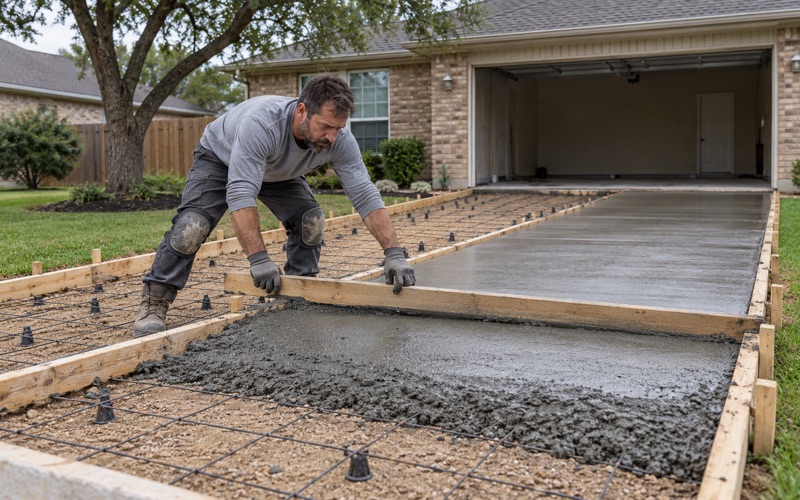
Excavation on the dominant units is a predictable duration rather than an open-ended one, which makes the rest of the program schedulable. Forming, steel and the concrete order can be planned against a date rather than against a range. That reliability compounds on larger jobs. Where a patio, a pad and a section of drive are being done together, knowing the excavation duration means the whole sequence can be planned as one operation rather than staged around an unknown.
Where the Ripping Assumption Stops
On the small share of the community mapped with indurated bedrock, the assumption does not hold and the equipment changes: a hydraulic breaker or rock saw rather than a ripper, at a materially different rate per yard. We check the mapping against the specific address at the estimate and confirm on site before committing to a price. Getting that determination wrong is the one thing that would turn an otherwise predictable job into an unpredictable one.
Fourteen Inches or Eighteen, and Which Unit Your Lot Is On
The Two Representative Depths
The gentler unit carries its paralithic restriction at a representative 46 centimeters, about 18 inches, and the steeper 8 to 30 percent unit carries it at 36 centimeters, about 14 inches. Those are representative values across a map unit rather than a guaranteed depth at any one point. Four inches sounds trivial and is not, because it lands right where footing excavation, thickened edges and drainage cuts operate. A trench that would have finished in soil on one unit finishes in rock on the other.
Reading Slope as a Proxy for Depth
Because the two units are separated by slope, the ground itself gives a useful first indication: the steeper the lot, the shallower the expected refusal. That is a helpful rule of thumb and not a substitute for checking. We look at the slope, the mapping and the site together. A relatively flat area within a generally steep lot can sit on either unit, and the boundary between the two is a mapped line rather than a visible one.
What Refusal Depth Changes About the Design
Where rock sits within the first 18 inches, the design responds by working with it rather than against it. Bearing on competent rock is an advantage for a slab, provided the transition between rock-supported and soil-supported areas is handled deliberately rather than ignored.
The failure to design for on this ground is differential support: part of a slab bearing on ledge and part on compacted soil, with a joint in the wrong place or no joint at all. We locate that transition and put a joint where the slab will otherwise crack. Over-excavating to a uniform depth is the other approach, and sometimes it is the right one. Removing rock so the whole slab bears on prepared base costs more in excavation and buys uniformity, and on a patio or a pad where appearance matters it is frequently worth the difference.
A Stiff, Low-Movement Subgrade, Which Is Not the Same as Good Soil
What Brackett’s Numbers Actually Say
Brackett carries a representative plasticity index of 17 to 18 and a liquid limit of 39 to 42 at 30 percent clay, but a linear extensibility of only 2.3 to 3.3 percent, because the profile runs 60 to 65 percent calcium carbonate. Those numbers pull in different directions and both have to be read.
Read alone, the plasticity index suggests a soil that moves seasonally. The linear extensibility says it does not move much at all. The accurate description is a stiff, rocky, low-movement subgrade, and the design problem is bearing and excavation rather than seasonal movement.
Real, which makes up 22 percent of the steeper unit, is even less mobile, with linear extensibility of 0.8 to 1.9 percent. That is very nearly immobile material.
Low Movement Is Not the Same as Uniform Support
Ground that does not swell can still be a poor base if it is loose, uneven or full of fragments, and shallow soil over rock is frequently all three. Low shrink-swell is one favorable property, not a general endorsement of the subgrade.
We still compact, still place base to the specified depth and still verify it, because a slab on stiff but poorly prepared ground cracks for entirely ordinary reasons. Skipping preparation because the soil does not heave is a common and expensive misreading. Fragment content is the specific issue on these units. Shallow soil over weathering rock carries a high proportion of coarse material, which compacts differently from graded base and leaves voids if it is simply pushed back and rolled.
Drainage on a Ridge With No Water in It
Steiner Ranch is a planned community and census designated place in Travis County, first listed as a CDP in the 2020 census with a population of 16,713, and it sits on a ridge between two lakes. Not one sampled point returned open water, and the gazetteer records no water area inside the boundary at all; the lake is the view rather than the parcel. On shallow soil over rock, water does not soak away, it runs, so where a slab sends its water is a live design question. We set fall deliberately and plan where runoff goes before the pour rather than after the first heavy rain demonstrates it.
- 20+ Years in Concrete
- Licensed & Insured
- Free Estimates